In disputed Sussiya, old Ottoman law still casts a shadow over the land
Ottoman law continues to influence court decisions, as the state neglects to act on land disputes.
By SETH J. FRANTZMANUpdated: AUGUST 19, 2016 13:04
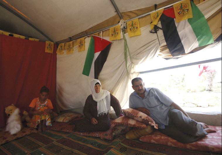
Last July, I drove out to the Palestinian community of Sussiya in the southern West Bank, where the residents were “counting down to their village’s demolition.”The US State Department was following Israeli court decisions, and urging the state to “refrain from carrying out any demolitions.”However the August 3 date that many said was when the village would be demolished came and went in 2015. The court asked the state and the residents to “update” it regarding “dialogue,” but according to B’Tselem, “talks between the state and Khirbet Sussiya residents that were under way during the past year were recently suspended.”On August 1 this year, the High Court of Justice noted that this dialogue had indeed “halted,” and that Minister of Defense Avigdor Liberman should make a decision. “At any moment, Israel’s Civil Administration might demolish all homes and structures in Khirbet Sussiya,” B’Tselem claims, based on a decision from a May 2015 High Court denial of an injunction stopping the demolition.However, it is not clear how much of Sussiya is slated for “demolition.” An earlier version of the B’Tselem website report noted that the Civil Administration “plans to demolish about half the structures in the village even ahead of 3 August 2015.” A report in 2012 noted the villagers were about to face “cruel and violent expulsion,” claiming 52 structures would be demolished. A protest vigil was held in September of 2013.The campaign to “save Sussiya” has been successful over the years – Sussiya has received support from the EU, many NGOs and most recently a protest vigil. And as Tovah Lazaroff reported on August 11, US consulate officials had visited the village, and State Department Press Officer director Elizabeth Trudeau said that a demolition would be “very troubling,” adding that Israel had demolished 650 other Palestinian structures in 2016.The Israeli Ministry of Foreign Affairs claims that “contrary to Palestinian claims that these structures have been permanently inhabited for decades, in fact, only a handful of families resided there in the 1980s, and they only used the structures on a seasonal basis.” In addition, they note that Israel seeks to demolish “only those structures that were constructed in defiance of judicial rulings,” which include those built in the last few years. The MFA claims that demolition will not make the people homeless: “Israel recognizes their traditional lifestyle and has proposed solutions that are appropriate to their special needs. They have been offered plots of similar, or even better, quality in a nearby area that already conforms to planning and zoning laws.”All this illustrates that there are two narratives about Sussiya’s history.Ari Briggs of Regavim articulated in an op-ed last year: “No such village has ever existed.” Aerial photos, maps, travelogues from the 19th century and other documents show no village, and claims to the contrary have been ruled “false” by the High Court. The extended family living at the site are “being encouraged by the Palestinian Authority…to illegally establish facts on the ground.” Regavim claims to have found 20 structures sponsored by the EU. The land is mostly state land, and the only private Palestinian land is agricultural.The other narrative is well articulated by Rabbis for Human Rights: the residents live in an “ancient historic village. Its residents lived in ancient caves for decades before the Israeli occupation of the West Bank.” They were moved by Israel from the caves 30 years ago and relocated to their current “private” land. “The residents were forced to erect tents and sheds to survive,” and the state has refused to provide building permits. The only solution is to allow planning for a village at the spot. The residents claimed to have rights to the land dating back to Ottoman times: In 2015, a document provided by the Jabor family claimed to show that they have a deed from 1881 during the Ottoman era.
The narratives appear contradictory, but lack a key piece of information.According to B’Tselem, there were “some 250-350 people, depending on the season” in the village in 2015. RHR claims there are 340 people, including 140 children. The high percent of children is confirmed by the UN Office for the Coordination of Humanitarian Affairs in Occupied Palestinian Territory.When one looks at demographics, it means that in 1998 there were, at most, 210 people in the village. With a population demographic doubling every 25 years that means the population of the village was around six people in 1881, when the deeds they have to agricultural land were presented to the Ottomans.This is the reason this “village” did not show up on maps and aerial photos.Like so many communities, it had a tiny population, albeit part of a larger Arab clan in the area, during the Ottoman and British times. What is particularly strange in the case of Sussiya and many other places like it, is that Israeli courts and discussions stretch back to Ottoman times. Arik Ascherman, the outgoing head of RHR, says that rather than applying the Fourth Geneva Convention – which would prevent transferring Israelis into the West Bank and thus reserve state land for Palestinians – Israel has relied on Ottoman land law to fit its needs. He describes a “kafkaesque” process when it comes to determining Arab land ownership in Israeli courts, because they don’t always accept “kushans,” or Ottoman era deeds, but delves into aerial photos and maps to see if agricultural land has been continuously worked.Israel has also not used master planning to prepare for growth in Palestinian communities, but has sought to plan growth of Jewish communities, including those like Jewish Sussiya which was established in 1982, not far from the Arab Sussiya that is the center of controversy today.Ostensibly, the Ottoman Land Law of 1858 – which sought to bring what was then a modern system to the empire – cuts both ways. Both sides use it to claim ownership of land by having worked the land for 10 years. The Ottomans had wanted a law that would allow private acquisition of rights to lands that were considered state lands outside of villages, where almost all of the population lived in the mid-19th century. Open land, sometimes referred to as mewat, or “waste land,” was used for grazing and dominated by nomadic tribes. From 1858, large swaths of this land were acquired for private use through working the land, similar to the US Homestead Act of 1862. This benefited the empire by encouraging development of the land. The Zionist movement – whose adherents began to arrive in Palestine in those years – also welcomed the modernization of land tenure to acquire land for rural settlements.The British, who ran Palestine for 30 years, sought to standardize the Ottoman land law, and to survey all of the land. However they never succeeded to extend their rigorous surveys to parts of the West Bank and Negev, especially desert areas that had few settlements on them, like where Sussiya is. The Jordanians neglected to continue with much survey work and settlement of title to villages in their brief stewardship. This left Israel with a land law in places like Sussiya that was often untouched since the 19th century.Rather than survey the land and complete the British process, Israel has tinkered with the West Bank. After the Oslo Accords, the state invested its resources in land disputes in Area C. The state has refused to publish maps of regions of the West Bank showing individual land holdings, preferring the opaque process of legal wrangling over each case. This results in the dispute over Sussiya dragging on for years.Regavim’s spokesman, Josh Hasten, says this benefits Palestinians and their international backers who seek to extend communities in Area C. “You have deliberate activity by Palestinian Authority financed by the EU, setting up encampments,” Hasten said. He points to a school near Kfar Adumim, claiming children are bused in from Area A and B to create “facts on the ground,” so that during negotiations with Israel there are structures. Since possession is ninetenths of the law in some legal settings, these new buildings will delineate new Palestinian rights to land.In some ways, the disputes Israel now has in Area C mirror those on the other side of the Green Line in the northern Negev, where some Bedouin communities, such as al-Araqib, are under demolition orders, and 70,000 people live in unrecognized villages. The same reference to the Ottoman era, and aerial photographs and maps are used to determine ownership in the Negev, and even as Bedouin lose court cases, their communities continue to grow and the state doesn’t plan for them. The state prefers to continue numerous unending legal struggles, a slow failure by a thousand paper cuts, rather than enforcing the law initially and planning for the future. This points to a convergence between Area C and Israel inside the Green Line, relying on colonial-era law, but without the bold changes the Ottomans and British sought to do with that law.Whether a few structures in Sussiya are demolished will not matter in the larger context – the continued tinkering rooted in the 19th century continues to cast a long shadow over the land.