An Israel-made system now provides information about wildfires around the world, tracking their spread to help ensure people's health and safety.
BreezoMeter, a Haifa-based company that provides data about air quality and pollen counts to consumers in more than 100 countries, said Tuesday that its fire tracking solution is now available for free on its air-quality map on its website . The feature should be available on its free app, available in the Apple App Store and Google Play, in the coming months.
A more sophisticated version of the data is available to businesses, governmental authorities and first responders via API, so they can integrate micro-local visualizations into command and control systems for full emergency use.
"It is very hard to predict how wildfires will spread," explained Dr. Yvonne Boose, BreezoMeter's atmospheric science specialist, to The Jerusalem Post. "You need to take wind, weather and other factors into account. Our solution integrates data from a number of inputs, including very high-resolution satellite images, to provide the most accurate information possible. There are some other products on the market for tracking fires, but none are available free for the public like ours."
The size and frequency of wildfires in Israel are increasing, as climate change causes hotter summers. Last month, wildfires burned some 4,940 acres of land west of Jerusalem in one of the worst blazes in the country’s history.

Meanwhile, the United States has experienced, on average, 100 more large wildfires every year than the year before since 2015, according to the National Interagency Fire Center.
BreezoMeter came into the wildfire tracking business by way of its focus on improving air quality. The company launched in 2014 to provide high-quality street-level data about air quality accurate for up to five meters from a user's location.
"Now, some of worst air pollution in recent decades is from wildfires," noted Tom Navot, fire algorithms team lead at BreezoMeter. "Wildfire smoke is something that people don't think about until they get sick from it, but its rise as a cause of death is rising."
Smoke from wildfires contains thousands of pollutants in particles less than 2.5 micrometers in diameter that can get deep into the lungs and into the bloodstream because they are small enough to bypass the body's natural defenses. Serious exposure to wildfire smoke can raise the risk of lung damage and may also contribute to cardiovascular problems.
In July, the Northeastern United States reported the worst air quality it has seen in over 10 years in response to west coast wildfires more than 3,000 miles away. And a recent study published in the medical journal The Lancet found that wildfire smoke causes more than 33,000 deaths a year across 43 countries.
"You should definitely not exercise outside or go out for a walk when there is smoke in the air," Boose said. "The best thing is to stay inside and close your windows and make sure your air conditioner is filtering particles. In wildfire country in California, they put wet cloths on the doors to prevent the air from outside from coming in."
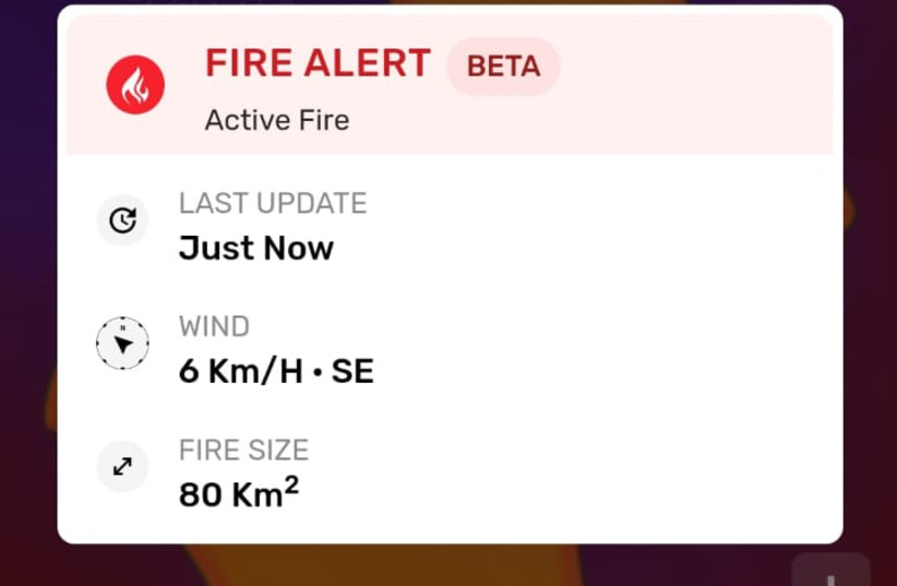
BreezoMeter's map allows users to see exactly where a specific fire is at any moment, as well as its distance and direction from their location, and its effects on the air quality around it. The visualization also lets users quickly view the total area consumed by the fire, its name, the wind’s speed and direction, the estimated time of containment, and the time of the last update.
The free service "is part of the company’s commitment to protecting people’s health by equipping them with more than what the eyes can see about the air they breathe, as the effects of climate change, pollution and fires increasingly affect air quality around the world," the company said.
The service can also help notify fire protection services of fires before they rage out of control, with the help of more than 47,000 local government sensors, as well as polar-orbiting and geostationary satellites, and other meteorological data. "We can identify fires before they are reported, and alert the proper authorities," Boose said. "In some areas, especially in less-populated countries, fires can go undetected because people don't report them. Obviously, the larger a fire gets, the harder it is to extinguish, so it is important to respond to a fire as quickly as possible."
The launch of BreezoMeter’s wildfire tracker follows the recent close of its $30 million Series C funding round and the expansion of its live air quality index on the Apple Weather App in 10 countries.
An upcoming version of the software will help guide commuters, hikers and joggers to find safe travel routes when fires are nearby. Integrations with smart home devices will also be able to alert users to evacuate their homes if needed.
